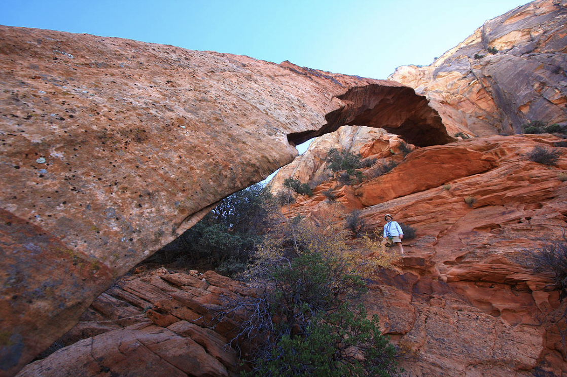
An Amazing Journey.
A classic Zion backcountry adventure, the complex journey out to Crawford Arch and back crosses an amazing landscape. Save this adventure for a crisp day in the fall or perhaps in the spring of a low-snow year. Get an early start and keep moving, or this could become an overnight-type adventure. The terrain traversed is some of the most beautiful in Zion.
The Crawford Arch route has several unavoidable and hazardous obstacles, so be sure your group has the skills and the fitness to complete the route in daylight. The route-finding is complex, and there is only one route. The chimney is real fifth-class climbing without protection, not at all spottable and would result in serious injury or death if one took a spill. Bring an experienced rock climber capable of soloing this bit of insecure, awkward climbing. Everyone attempting this route should be comfortable on 4th class terrain without a belay.
In addition to the traditional route popularized by Brereton and Dunaway, this description includes variations on the approach and the exit. The Wedge, a fun, downclimbing-filled canyon can be done on the approach. A dramatic trip down Notch 2 Canyon, featuring a 300-foot final rappel, compliments the exit. Alas, this canyon is closed in the spring for peregrine nesting. Check with the Wilderness Desk to see if the Tunnel Wall closure is in effect.
WGS84 Zone 12S Waypoints (UTM):
Flat Spot in Gifford Canyon head up: 328060 mE 4118950 mN
Top of first pass: 327500 mE 4118485 mN
Mouth of wash heading up to Notch 2: 326320 mE 4119540 mN
Crawford Arch: 325370 mE 4119683 mN
Mouth of exit canyon: 326700 mE 4118590 mN
Canyon Profile
Logistics

RATINGS
Normal Route: IV 5.5 (R/X) (climbs and raps to 40 feet) ★★★★☆
The Wedge: add – 3a (raps to 110 feet) ★★★☆☆
Notch 2 Canyon exit: add – 4a (raps to 300 feet) ★★★☆☆

TIME REQUIRED
10-12 Hours

PERMIT
Normal route: none. The Wedge and the Notch 2 Canyon require a permit.

SEASON
Summer or Fall. Possible in low-snow spring. Notch 2 Canyon exit is often closed in the spring for raptor nesting.

LONGEST RAPPEL
See above
Equipment

ESSENTIALS
Helmets, rappelling gear, webbing and rapid links. The canyon exit is rarely done, so there is a good chance you will need to rig at least a couple of anchors. Rope.

COLD WATER PROTECTION
None required.

DRINKING WATER
Bring plenty. Reliable water is not found on this route.

ACCESS
Begins at Canyon Overlook Parking Lot
difficulties

FLASH FLOOD RISK
Moderate to Low – However, climbing the slickrock in wet conditions could be difficult to impossible.

SKILLS REQUIRED
Good route-finding skills! The chimney requires a climber capable of doing a short 5.5 section solo, well off the deck. All party members should be solid on fourth-class terrain without a belay. The Wedge and the exit canyon require the ability to construct solid natural anchors. The exit canyon requires experience with long, multi-stage rappels.

ANCHORS
On normal route, the one rappel is off a tree. The Wedge has one rappel and is anchored by webbing around a tricky flake. Raps in Notch 2 Canyon are off trees and rocks, except the big, multi-stage exit rappel which is bolted. Please do not add bolts to these canyons.
Approximate times for a small, fit group:
Driving from Springdale: 15-30 minutes (depending on tunnel traffic)
Car Spot: on the way, if taking the Canyon 2 exit.
Approach to the top of the first pass: 1:15
First pass to the top of Notch 2 pass: 3:00
Notch 2 pass to Crawford Arch: 1:30
Enjoy the Arch: 1:00
Return to top of first pass: 3:30
Back to parking lot: 1:15
Total Car to Car: 12 hours
Getting there
Spot an Exit Vehicle
If using the Notch 2 Canyon exit, spot a car at the highest switchback west of the Tunnel.
Park at Tunnel East
Park as for Pine Creek at one of the parking lots close to the east end of the Zion-Mount Carmel Tunnel.
Approach
From the small parking lot adjacent to the bridge, look across Pine Creek and you will see a canyon dropping into Pine Creek from the south – this is Gifford Canyon, your approach canyon. Take the steep trail at the southern edge of the bridge down to the floor of Pine Creek. Turn left and scramble up Pine Creek about fifty feet to the dryfall at the end of Gifford Wash. Continue up Pine Creek just past the dryfall and climb up low-angle slickrock to a trail that heads left and up and then cuts sharply back right and around into Gifford Wash above the dryfall. Follow the flat sandy wash south about half an hour to a large, flat, sandy area.
Above to the right is a large slickrock face, with a beehive-like peak. Walk to the base of the slickrock. Climb the face toward the beehive, weaving back and forth to utilize the ramps and lower-angle inclines. Arrive at the top of the face where it becomes fairly bowl-like. Climb to the top of the bowl; you are aiming for a rectangular white rock near the center.
From the white rock, look up and left to note a smooth, orange wall trending left. Climb up toward this wall (4th class). At the base of the smooth wall, follow a broad gully with large pine trees up and left. Follow faint trails up to a viewpoint on a ridge. Contour south, using a ramp/gully to surmount a short cliffband. Contour south again into a second large slickrock bowl then around the bowl to the opposite side. Go up easy slickrock to the top left of the conspicuous cliffband. This is the first pass, a large flat sandy area with gorgeous ponderosa pines. Look back the way you have come from time to time and familiarize yourself with the return route.
Directly in front of the pass is a steep sandstone peak. The normal route goes to the right (north) of this peak; for The Wedge, hike to the left (south) of this peak.
The Business
Normal Route
The next section descends the canyon north of the peak. From the pass, head north to the edge of the bowl forming the top of the canyon. Descend easy ramps (with good echoes) down into the bowl, zig-zagging at the bottom to attain the sandy wash. You might be tempted to follow this wash downcanyon, but it soon cliffs out. Instead, immediately follow the sandy wash UP and north toward the next mountain north then left up to a pass between a fin and the mountain. Climb steeper rock to the NEXT pass between a larger fin and the mountain. From this pass, contour into the broad gully that heads back down into the canyon. Follow the gully down to the base of the cliffband that blocked descent of the canyon, staying to the left to find the easiest line. You are back in the bottom of the canyon. Follow the smaller canyon out to the main canyon running north, Hepworth Wash.
The Wedge (variation)
From the pass, head left of the sandstone peak out across flat sand then down sweeping slickrock terrain. It looks like a rappel will soon be necessary, but the V nature of the slot and the marvelously-featured rock make for a great section of downclimbing instead. Follow the slot down through several sections until it opens. A final vertical drop of 110 feet will require a rappel to reach Hepworth Wash. Follow the wash to the right (north).
Follow the winding, sandy streambed, staying out of the vegetation on either side as much as possible. Where the next canyon comes in on the right (the normal route) step up on the sand to the right to avoid some bad brush. If the normal route is your exit route, take careful note of this canyon for the return trip.
Hepworth Wash
Hike downcanyon, staying in the wash as much as possible. About 30 minutes north of the normal route, you get your first view of Bridge Mountain and the ridge descending from it. Continue down Hepworth Wash to the mouth of a wash that comes down from the area east of Bridge Mountain.
The route to Crawford Arch goes through what I call “Notch 2”, the notch closest to Bridge Mountain. Follow the wash up towards Bridge Mountain, then take the split that heads toward Notch 2. Close to the rock, where the terrain steepens, a social trail is followed up to the notch. Descend the other side 150 yards to where a scree and oak covered ledge cuts left. Take the ledge, and then climb up and left around a corner into the bottom of a chimney. Scramble up the chimney to the base of the “climbing obstacle”.
Climb up on the log (if present) then awkwardly onto the rock (one move of 5.5), and then squeeze up the chimney above. The first person up should trail the rope. Establish a belay and bring the others up. Please note that the hard move is about 15 feet off the ground, and falling here would be very bad.
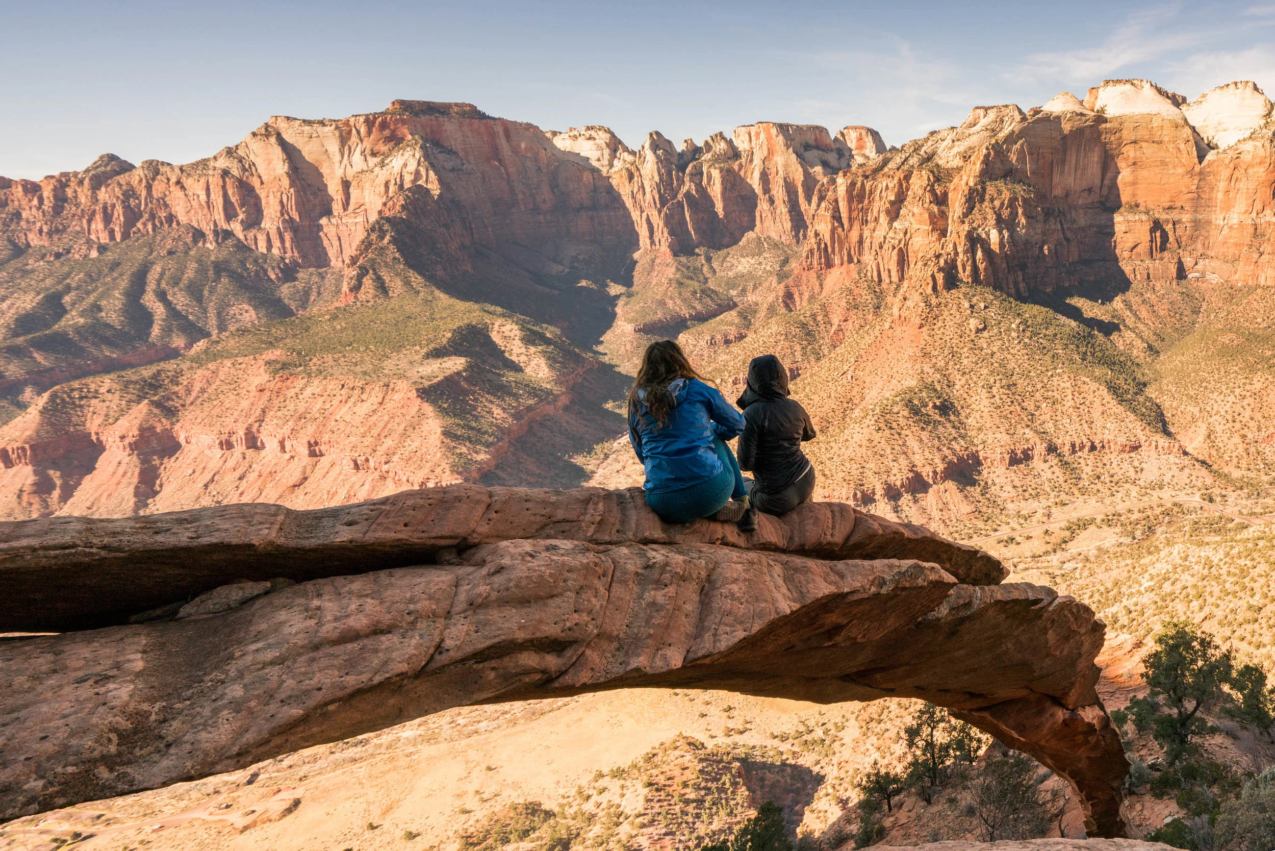
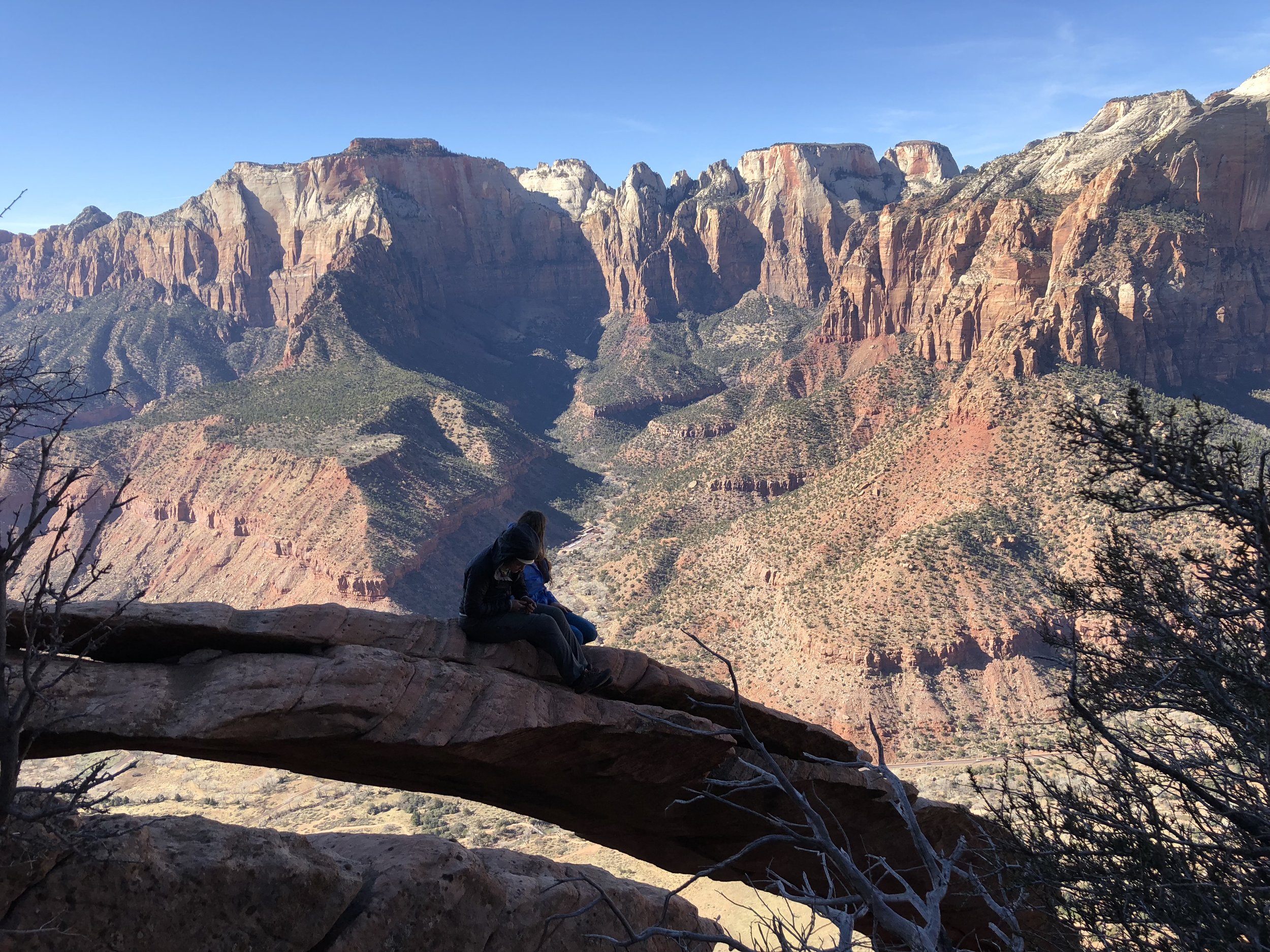
Above the chimney, you can leave your rope and rappel gear. Continue up the steep ramp/gully until an easy slab traverse is available on the right. Follow the slab around to the northwest shoulder of Bridge Mountain then down to a sandy area. From the far end of the sandy area, Crawford Arch can be seen to the south. Traverse the rocky terrain over to the arch.
Return the way you came, rappelling into the chimney off a tree a few feet past the upper part of the chimney you climbed. Please do not leave any fixed rope or other equipment to facilitate the “climbing obstacle,” and remove any that you find there (except for the rap anchor).
The Exit
The normal exit returns up the normal route. For those that came down The Wedge, I will give a description of how that goes.
Hike back up Hepworth Wash to the “normal route” canyon you noted on the way in. Hike and climb up the canyon until you cannot, blocked by a 20 foot vertical wall. Follow ramps up and left several hundred feet until you can cut around the back of a fin. Scramble around the top of the next fin too, which puts you in the main wash. Go down the wash 100 yards, and then climb the wall directly ahead via ramps to the top of the pass and the sandy area where you came in. Follow your approach route back down into Gifford Wash.
Variation: Notch 2 Canyon
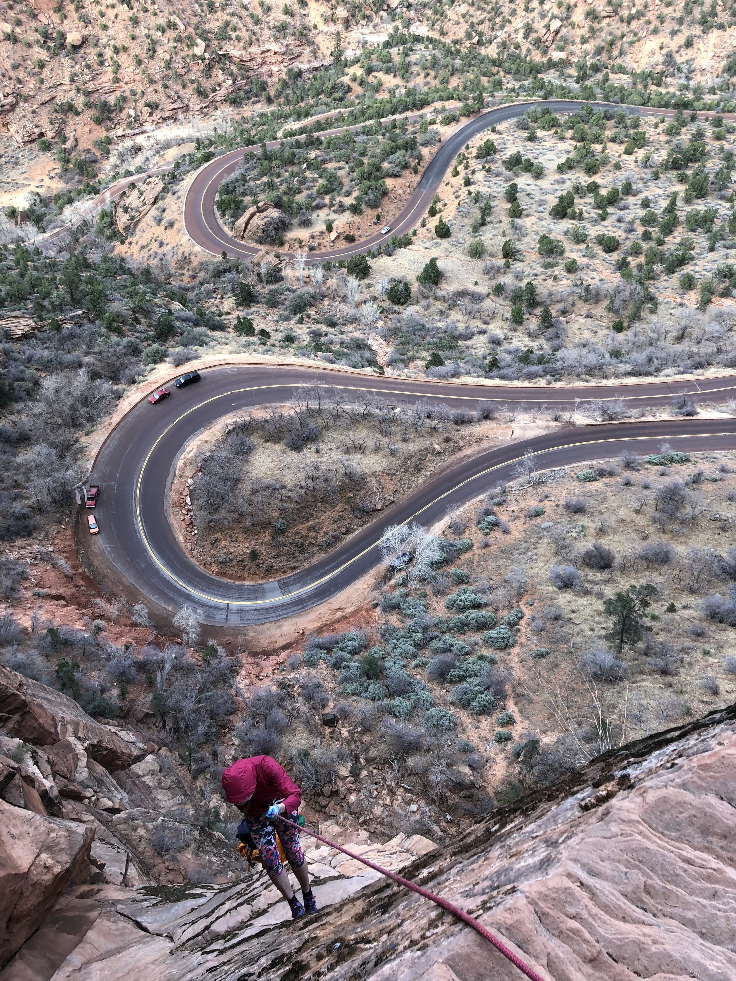
After rapping into the climbing obstacle chimney, descend the chimney and ledges back to the main gully. Head DOWN the gully, soon coming to a short rappel off a tree. Not far below is a longer rap off a tree, perhaps 100’ or so. Continue down until you come to a dramatic edge. Rap 40’ off a rock anchor to a ledge with a two-bolt anchor. Rap 300 feet down a steep wall to a large ledge. From the east end of the large ledge, downclimb and rappel 40 feet to the ground. Downclimb steep dirt and bushes to get to the road.
Trip Reports
Maps
Click for higher resolution

