
Zion Historical Photographs

Historical Photographs - While working on my Zion canyoneering guidebook, I came across the National Park Service Archive of Historical Photos and the USGS Archive of Photographs. Here are some from Zion I found interesting.
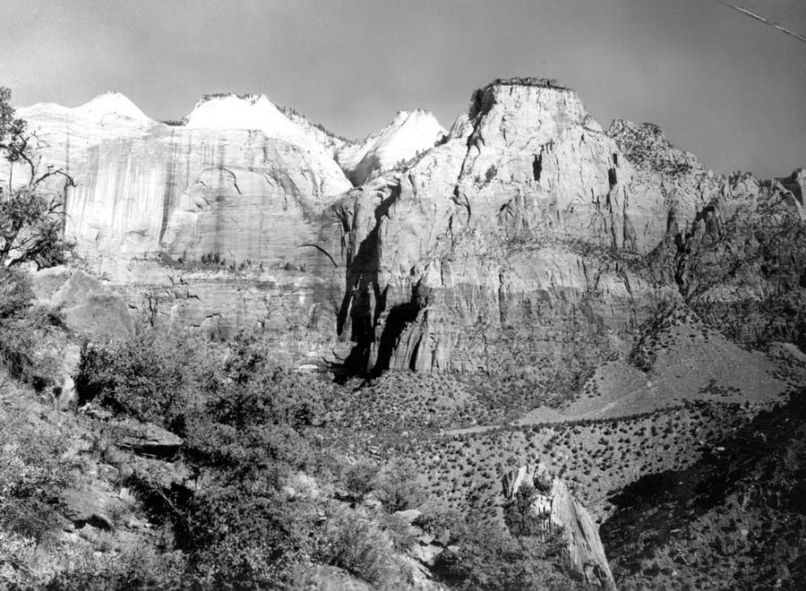
Zion National Park, Utah. Navajo Sandstone that forms the Sentinel. Upper part, white, massive, cross-bedded, capped by limestone of the Carmel Formation. Lower part, made dark red by abundant iron cement, consists mainly of bedded sandstone. Talus cone and landslide debris (middle and lower left). 1938. Figure 50, U.S. Geological Survey Professional Paper 220. Professional Paper-0220

Zion National Park, Utah. Virgin River in Zion Canyon at a time of rapidly increasing volume when water and transported sediment are combined in “sand waves”. 1938. Figure 105-C, U.S. Geological Survey Professional Paper 220. Professional Paper-0220

Approximate Year: 1929
Park: Zion National Park
Photographer: Grant, George A.
Description: View through trees (with visitors) down Zion Canyon from east side of Observation Point. Great White Throne at left. October 1929.
Additional Comments: 5″ x 7″ b/w print

Postcard: now the Nature Center, was the Cafeteria.

Photographer: Grant, George A.;
Year: 1929;
Description: Horseback party on East Rim Trail. 9/12/1929.
Parksite: Zion National Park.

Approximate Year: 1957
Park: Zion National Park
Photographer: Pickering, S. Horace
Description: Waitress Sing Away at Zion Lodge.
Additional Comments: 8″ x 10″ b/w print
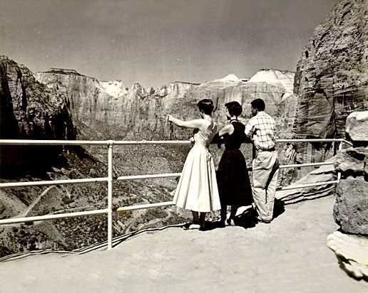
Photographer: Whitmoyer, Theodore F.;
Year: 1955;
Description: Carolyn Smith, Margaret Grooms, and Norman Akita enjoy the spectacular view from end of Canyon Overlook Trail atop of Great Arch of Zion.
Parksite: Zion National Park.
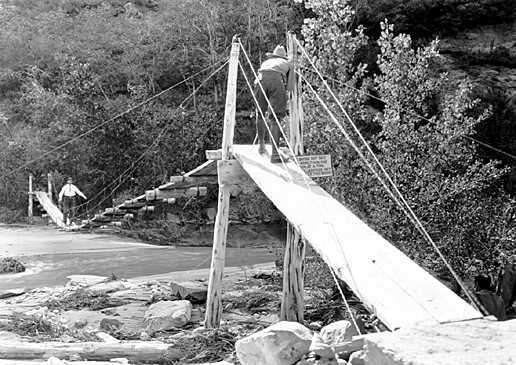
Approximate Year: 1929
Park: Zion National Park
Photographer: Grant, George A.
Description: Mr. Arthur Newton Pack, of Nature Magazine, taking motion picture of Mr. Brian on suspension bridge in front of Zion Lodge.

Zion National Park, Utah. Entrenched meanders of the Virgin River at the upper end of Zion Canyon, Temple of Sinawava. The walls of Navajo Sandstone rise 1,800 to 2,200 feet above the river. Photo by Army Air Corps. Figure 94, U.S. Geological Survey Professional Paper 220. Professional Paper-0220 Gregory, H.E. 1950

Zion National Park, Utah. Erosion surface developed on Carmel formation. Flatlands (upper middle) are in process of dissection by Virgin River (bottom center) and its tributaries. The view includes 14 canyons, each as much as 800 feet deep. Washington County, Utah.n.d. (Photo by National Park Service) (Aerial photo) Published as figure 95 in U.S. Geological Survey. Professional paper 220. 1950. Professional Paper-0220

Zion National Park, Utah. South entrance to The Narrows of the Virgin River. The stream flows between walls 1,500 to 1,700 feet high in a channel 20 to 50 feet wide. n.d. Figure 101, U.S. Geological Survey Professional Paper 220. Digital File:ghe01279
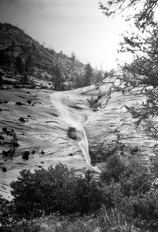
Zion National Park, Utah. Ephemeral stream, a tributary to Clear Creek, showing conditions favorable for making pot holes. n.d. Photo by U.S. National Park Service. Figure 126, U.S. Geological Survey Professional Paper 220. Digital File:ghe01280

Zion National Park. The Three Patriarchs. Parts of the White Cliffs (Navajo sandstone) separated by tributaries to the Virgin River. Tops of monuments are at level of Kolob Terrace. Height above river in trench at their base is 2,200 feet. Washington County, Utah. n.d. Published as figure 7 in U.S. Geological Survey. Professional paper 220. 1950. Professional Paper-0220 Digital File:ghe01304
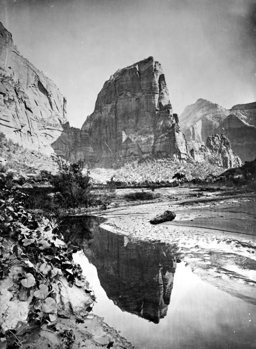
Zion National Park, Utah. Tower reflected in the Virgin River.U.S. Geographical and Geological Survey of the Rocky Mountain Region (Powell Survey). 1872 Digital File:hjk00073
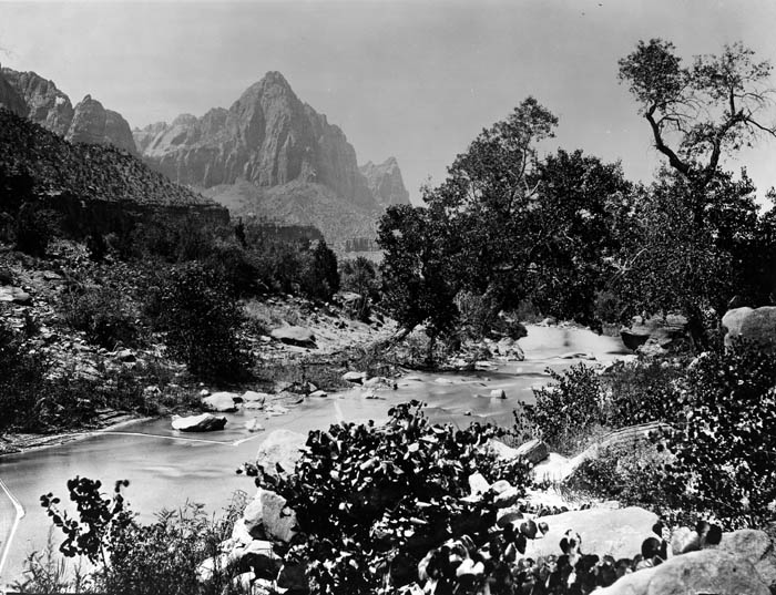
Zion National Park, Utah. The Watchman, as seen from the Virgin River.U.S. Geographical and Geological Survey of the Rocky Mountain Region (Powell Survey). Negative cracked. Digital File:hjk00075

Zion National Park. Castle Domes. Peaks from Sun Mountain to East Temple .U.S. Geographical and Geological Survey of the Rocky Mountain Region (Powell Survey). 1872. Digital File:hjk00076
Zion National Park, Utah. Zion National Park, Utah. Cathedral Mountain, May 9, 1953. Digital File:crb00678
(Well, not really. Usually called the Great White Throne).
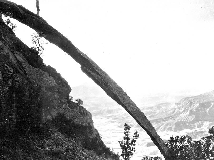
Zion National Park, Utah. Rock buttress on Bridge Mountain overlooking Virgin Valley at Springdale, UT. Length of curved Navajo sandstone, 156 feet long, width at base 6 feet, at top 4 feet. Washington County, Utah. n.d. (Photo by E.Y. Scoyan, National Park Service) Published as figure 123 in U.S. Geological Survey. Professional paper 220. 1950. Professional Paper-0220 Digital File:ghe01288
(Unfortunate that this reproduction, at least, cuts off the head).

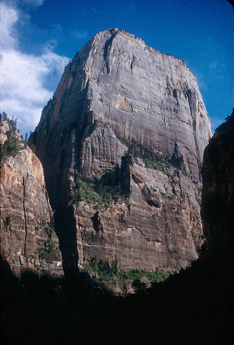
Zion National Park, Utah. The White Throne, monolith of Navajo Sandstone; upper half, white. Height above Virgin River at base, 2,394 feet. Zion National Park. Washington County, Utah. n.d. Published as figure 46 in U.S. Geological Survey. Professional paper 220. 1950. Professional Paper-0220 Digital File:ghe01306
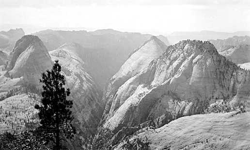
Zion National Park, Utah. HPC-000819

Zion National Park. AJC 000211934 Temple of Sinawava